Take Another Self-guided Forest Walk
Follow the Tam Van this summer on Mt. Tamalpais!

A self-guided experience at Muir Woods National Monument

Alison Taggart-Barone / Parks Conservancy
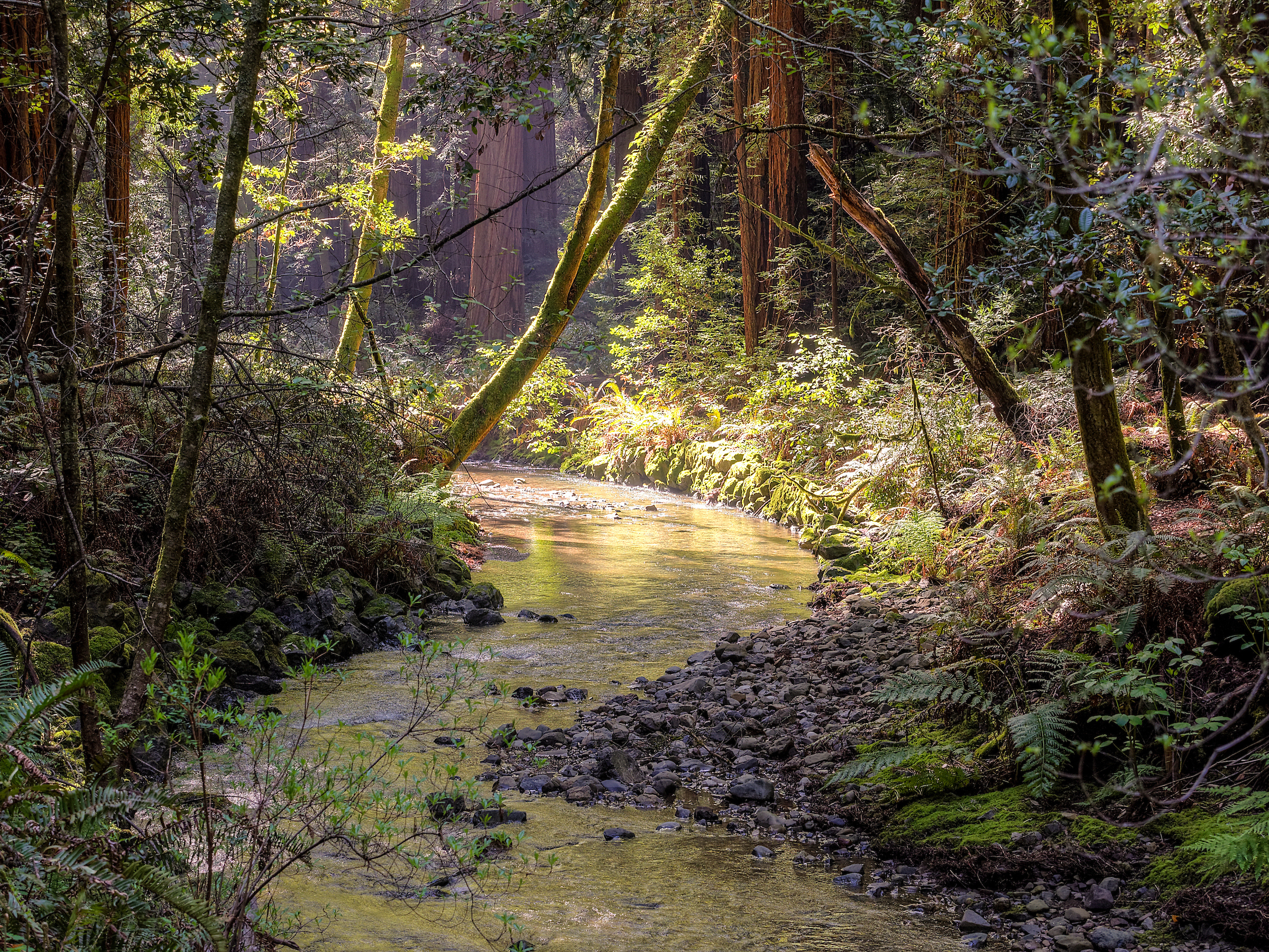
This self-guided experience follows Redwood Creek as it winds through the heart of this ecosystem. You’ll cross waters that nurture redwoods, explore life-giving relationships between streams and salmon, and learn how the National Park Service, the Golden Gate National Parks Conservancy, and the Federated Indians of Graton Rancheria are working together to care for this place.
As you follow the main path beside Redwood Creek, each stop marked here offers a moment to pause and reflect on a part of the story. This self-guided experience starts at the main entrance.
Shao-Feng Hsu / Parks Conservancy
Welcome to Muir Woods National Monument, a sanctuary where the waters of the Redwood Creek watershed sustain towering coast redwoods. Since time immemorial, water, fire, and Coast Miwok stewardship have shaped this forest, creating a rich, interconnected ecosystem. As you step into this ancient forest, you enter an environment as intricate as the tributaries that feed its life.
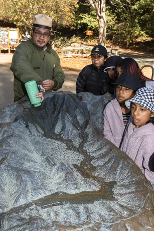
Reflection: Find the model of Redwood Creek’s watershed in the Welcome Plaza. Where are you on the model? How does water flow here?
Now, pause for a moment. Can you hear the creek flowing? What else do you hear? Take a deep breath in. As you exhale, know you’re about to enter a magical place shaped by water, time, and towering trees.
Directions: Step beneath the Muir Woods arch and continue toward Bridge #1.
The coast redwoods of Muir Woods rise above Redwood Creek, their roots nourished by its steady flow. These ancient trees, some over 800 years old, act as reservoirs. They capture carbon dioxide and fog, and channel moisture to the forest floor and the creek below.
Beneath the soil, redwood roots and fungi connect the trees in a vast underground network. These fungi extend redwood root systems, helping trees absorb water and nutrients. They also enable redwoods to communicate, share resources, and support each other’s survival.
Reflection: Redwoods are like anchors in their forests. Who or what are anchors in your life, or in your community? What do they share with redwoods?
Directions: Continue down the boardwalk until bridge #2. As you walk, notice the soft rush of the creek beside you.
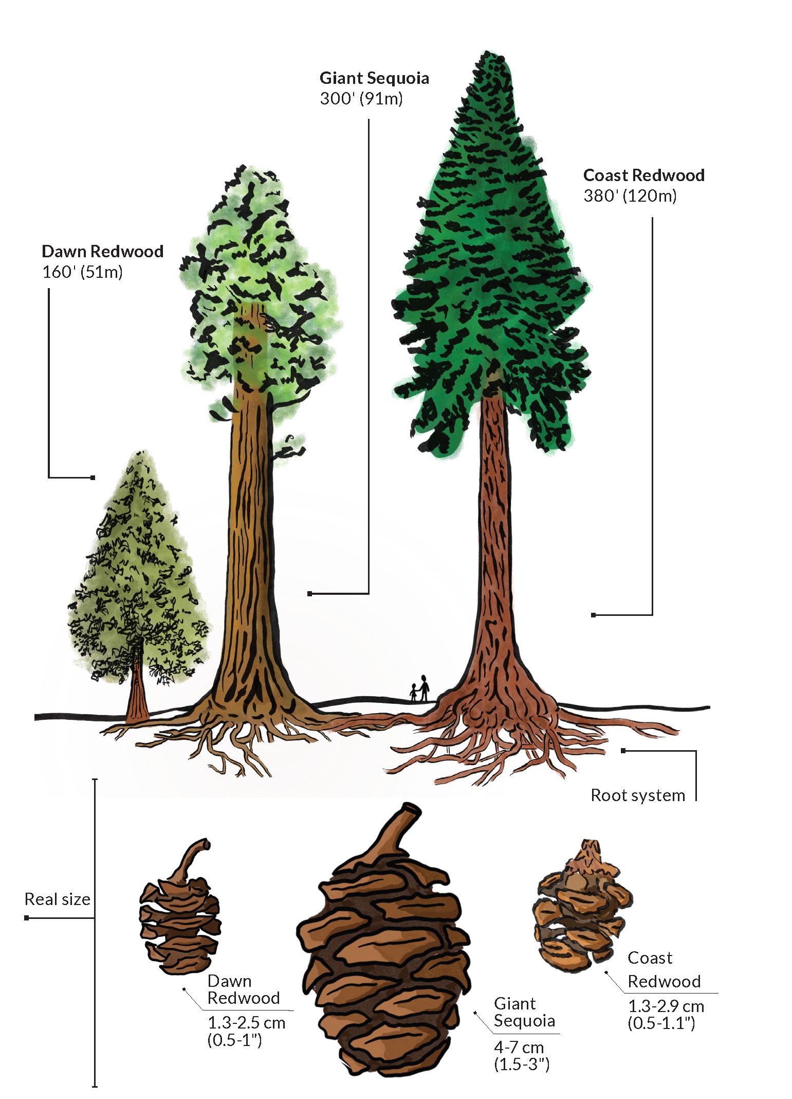
Illustration by Ryan Kilmer
Three redwood species currently exist in limited ranges. Coast redwoods are the tallest trees on Earth, and grow in a narrow strip along the coast of central California to southern Oregon. Giant sequioas are the largest, some reaching over 30 feet across. They only grow in pockets on the western side of California’s Sierra Nevada mountains. Dawn redwoods, the shortest, occur in drainages in the Sichuan and Hubei provinces of south-central China.
Water is the lifeblood of the redwood forest. Without enough moisture, these towering trees—and all the life they support—couldn’t survive. The Redwood Creek Watershed acts like a basin with the creek as its main waterway, collecting enough water for redwoods to thrive here.
Fog, a near-constant companion, weaves through the canopy delivering additional water directly to the redwoods and the understory plants below. Formed over the Pacific Ocean, moist air is carried inland and pushed up Mount Tamalpais, where it cools and condenses into clouds and fog. This condensed moisture falls as rain, cascading down the mountain’s slopes to feed Redwood Creek, or becomes fog drip as it condenses onto redwood leaves high in the canopy.
Redwood Creek is part of a global cycle. The Pacific Ocean’s moisture connects this forest to faraway places, reminding us that changes anywhere in the cycle affect life here.
Reflection: What roles does water play in this forest? Where does it come from, and where is it going? Where does the water in your community come from?
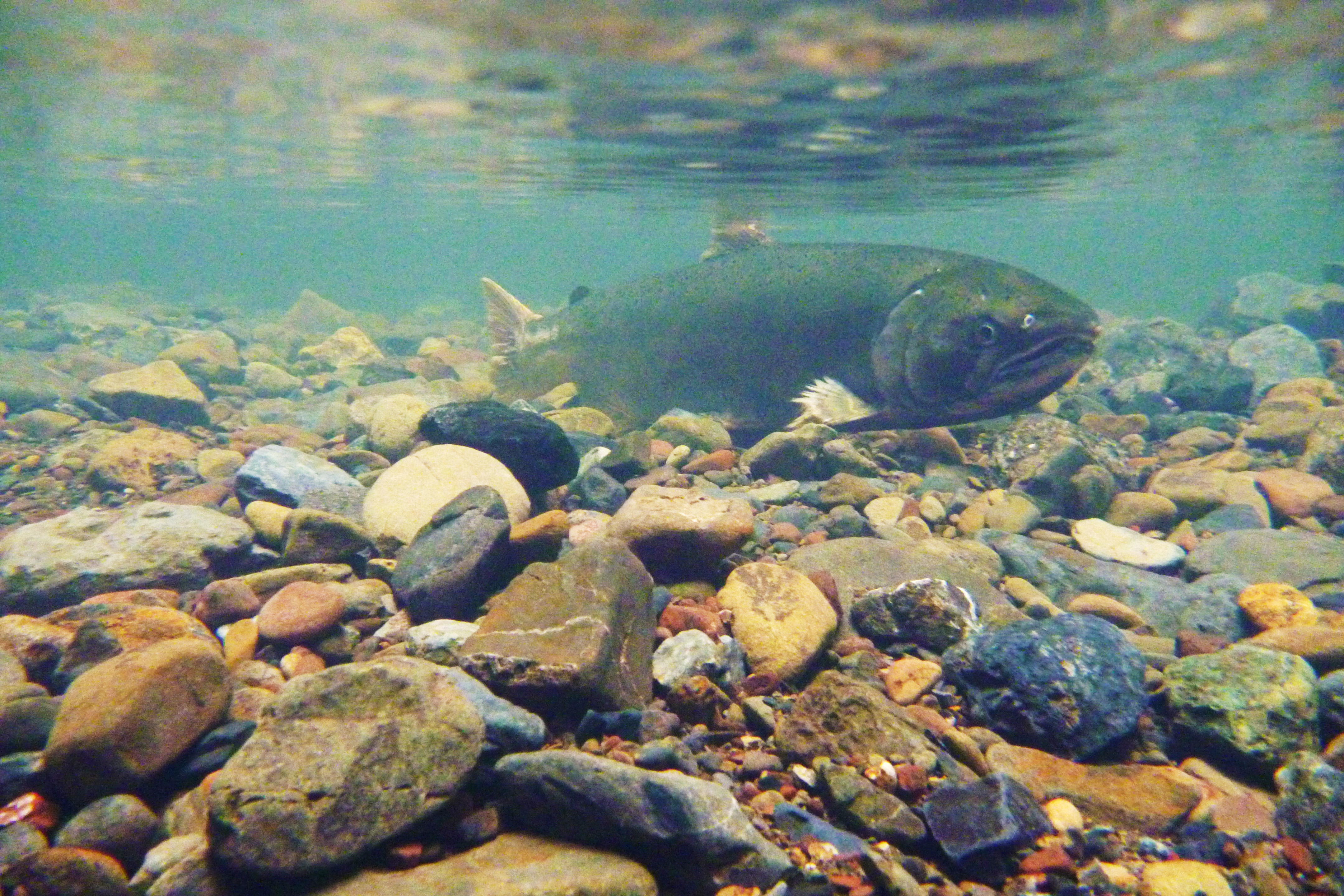
Once teeming with coho salmon, years of colonization-era changes—channel straightening, vegetation removal, and road construction—reshaped the stream, eroded its gravel beds, and fragmented habitat. Heavy rains added sediment and turbulence, overwhelming the creek’s delicate balance and endangering the salmon that once thrived here. But the story of this watershed is not one of loss alone, it’s a story of return.
Jessica Weinberg McClosky
Directions: Let the movement of Redwood Creek guide your steps as you follow the path toward Bridge #3. Ahead, the story shifts—from decline to renewal—as community care brings this watershed back to balance.
Modified from National Oceanic and Atmospheric Administration |
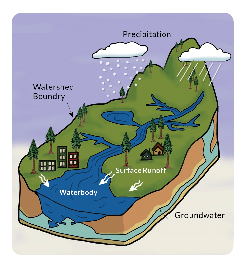
A watershed is an area of land that channels water from rain, snow, and springs into a common body of water, such as a river, lake, or ocean. Watersheds can be any size, with smaller ones nested within larger ones. Their boundaries are determined by land formations and geology which affect water’s flow. Watersheds are important because the movement of water across a landscape affects all life within it. Redwood Creek is the center of its namesake watershed. |
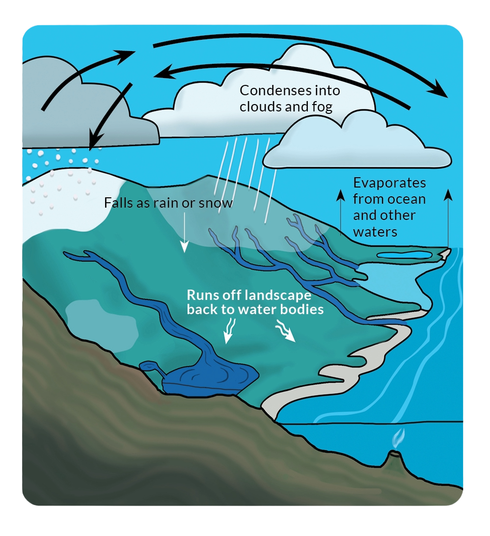
Modified from National Oceanic and Atmospheric Administration |
The water cycle describes the continuous movement of water between the Earth’s atmosphere, oceans, and land. This happens through processes including evaporation, condensation, precipitation, and the movement of water across watersheds and by ocean and air currents. Every part of the planet is connected by this cycle. |
In 2003, public agencies, community members, resource managers, and the Tribe came together to develop a shared vision to support cross-boundary planning, decision-making, and cooperative management. The Redwood Creek Watershed vision promoted a healthy ecosystem that welcomes people to experience and care for its beauty and history. Today, this vision flows forward through coordinated restoration, science-based management, and a commitment to stewardship.
California State Parks, Marin County Parks, Marin Water, National Park Service, and the Parks Conservancy work across boundaries as the One Tam partnership. One Tam and the Federated Indians of Graton Rancheria are working to heal the land and water. Their efforts form a powerful current of renewal for Redwood Creek through:
Replanting native plants: Their roots stabilize creek banks and provide cooling shade for animals and fish such as salmon.
Restoring salmon habitat: Gravel beds, deep pools, and log jams create places for spawning and shelter.
Reestablishing natural flow: Removing artificial barriers like the boulders that lined the creek for decades, moving sections of trail, and reopening its connection to the ocean, allows the creek to move and adapt naturally. Climate resilience increases through slowing the flow of water, especially during heavy rain, and expanding habitat for all life stages of aquatic species.
This long-term restoration effort is a testament to water’s transformative power—one ripple at a time, it reshapes the land and rekindles life. Redwood Creek reminds us that with care and collaboration, renewal is always possible.
Reflection: As water moves through the landscape, it leaves a lasting impact. What actions are you taking to reduce harm and increase your positive impact on people and place? What have you seen others in your community do?
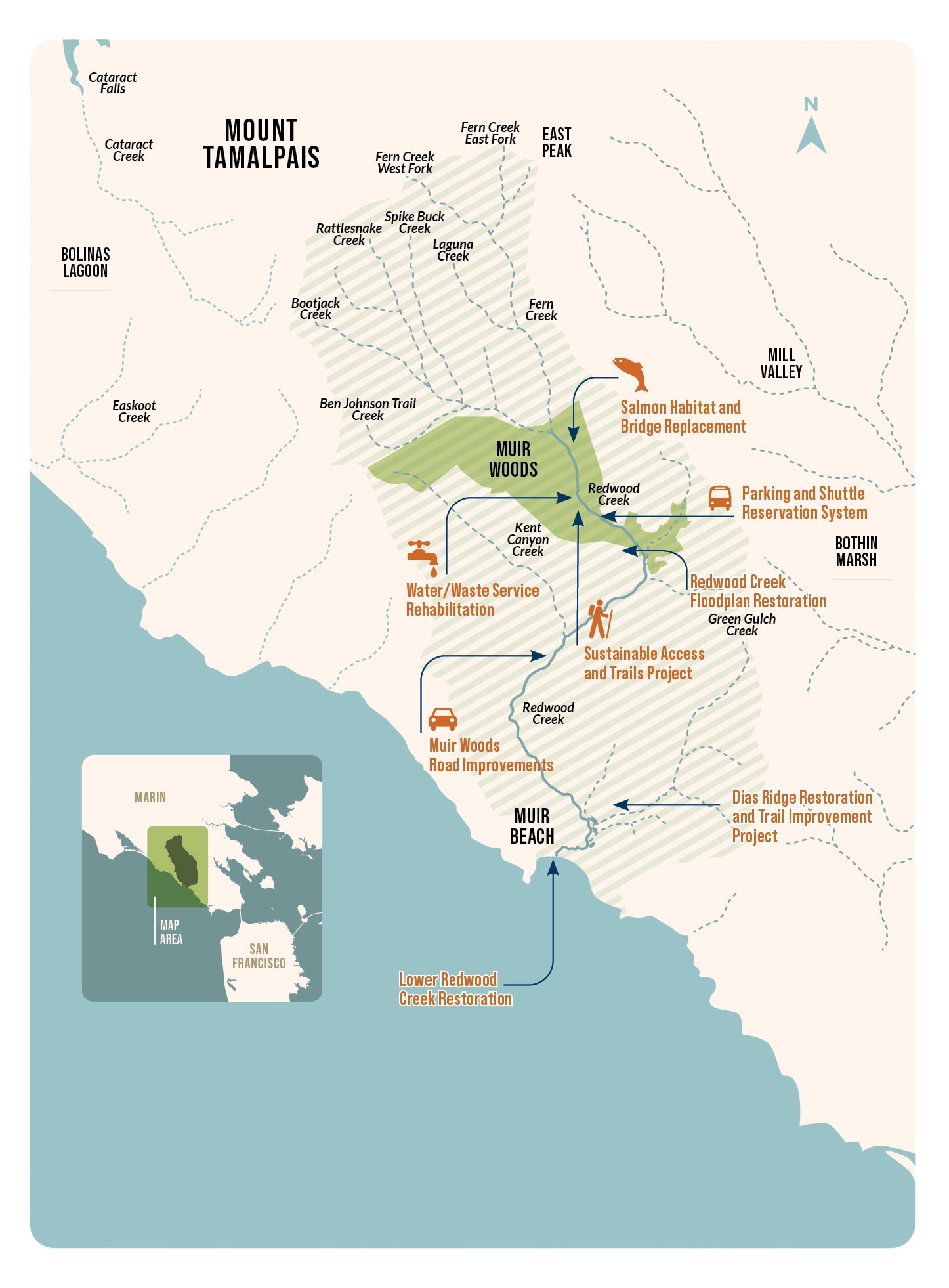
The Redwood Creek Watershed starts at the top of Mt. Tamalpais, concentrates water in Redwood Creek, and flows out to the Pacific Ocean at Muir Beach. Muir Woods sits in the watershed's small valley. Within their range, redwoods can live only where there is sufficient water to meet their needs. This special place would not exist without the conditions the watershed creates.
One Tam partners are working together to heal past damage to the watershed's ecosystems. The above map shows some of these collaborative projects.
Directions: As you enter Cathedral Grove, let the towering redwoods guide your steps. Walk slowly, speak softly—or not at all—and allow space for listening. This path reflects stories of fire and resilience.
All of Marin County, including Muir Woods, is Coast Miwok land. Today, the Coast Miwok are represented by the Federated Indians of Graton Rancheria (the Tribe), the only federally recognized Tribe with ancestral ties to this area. Since time immemorial, the natural processes that occur in Marin’s forests provide benefits for all beings in the region, and all these natural processes and beings benefit from Tribal use and stewardship according to the Tribe’s ecological knowledge and relationships with the environment.
The Tribe is currently partnering with the National Park Service to bring beneficial fire back to Muir Woods. Beneficial fire includes prescribed burns, pile burning, cultural burning by Tribal peoples, and other kinds of managed fire that restores fire to landscapes to boost ecological resilience.
One Tam continues to consult and collaborate with the Tribe to inform NPS and Parks Conservancy efforts to bring beneficial fire back to Muir Woods and other forest health projects. This collaboration is vital in order to ensure the Tribe’s knowledge are part of One Tam’s work.
Reflection: What would your life be like without fire?
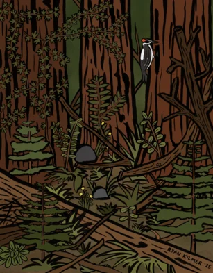
This image represents a forest in need of beneficial fire. What clues show this? Landscapes of present-day Marin County, and across California, have been shaped by fire for millennia. Decades of fire suppression policies have led to challenges, such as the build-up of excess vegetation on the forest floor and in the understory (fuel).
Illustration by Ryan Kilmer |
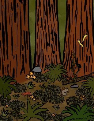
This image represents a healthier forest that has received beneficial fire. What is different from the image above? Returning beneficial fire to forests like Muir Woods will increase forest health by clearing excess fuels, recycling nutrients, supporting native species, and reducing forest disease and invasive species.
Illustration by Ryan Kilmer |
Directions: As you move beyond the grove, follow the path as it winds gently alongside Redwood Creek. At Bridge #4, we'll explore how all of us can shape the future of places like this.
Dan Friedman
As Redwood Creek winds through Muir Woods, it reflects the deep connections between land, water, wildlife, and people. Each drop reminds us of our shared responsibility to care for these relationships.
Together, we can act as tributaries (small streams) combining into a greater river. We can restore habitat, make choices that support ecological balance, learn about watershed health, or support conservation efforts. Just as Redwood Creek sustains the redwoods and salmon, so too can our collective actions sustain the planet.
Let’s move forward as stewards of these lands—here and wherever we live—carrying the lessons of Redwood Creek and remembering that even small ripples can lead to lasting change.
Reflection: What are ways you can act as a tributary in your community? What other tributaries do you see coming together to make a difference?
LEARN MORE ABOUT:
Forest health | Federated Indians of Graton Rancheria | Muir Woods
DOWNLOAD:
SUPPORT:
Our forest health work is a One Tam collaborative effort.

Note: Some parks in Marin County require an entry fee. Use your Marin County Free Library card to check out a Park Pass and visit for free!
Take Another Self-guided Forest Walk
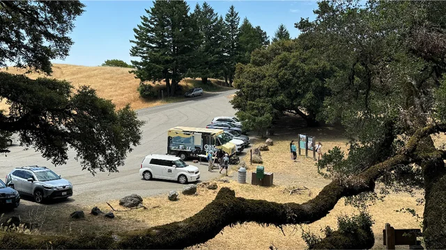
Follow the Tam Van this summer on Mt. Tamalpais!

Download PDF: Self-guided forest walk at Muir Woods

Download PDF: Self-guided forest walk at Muir Woods (Español)

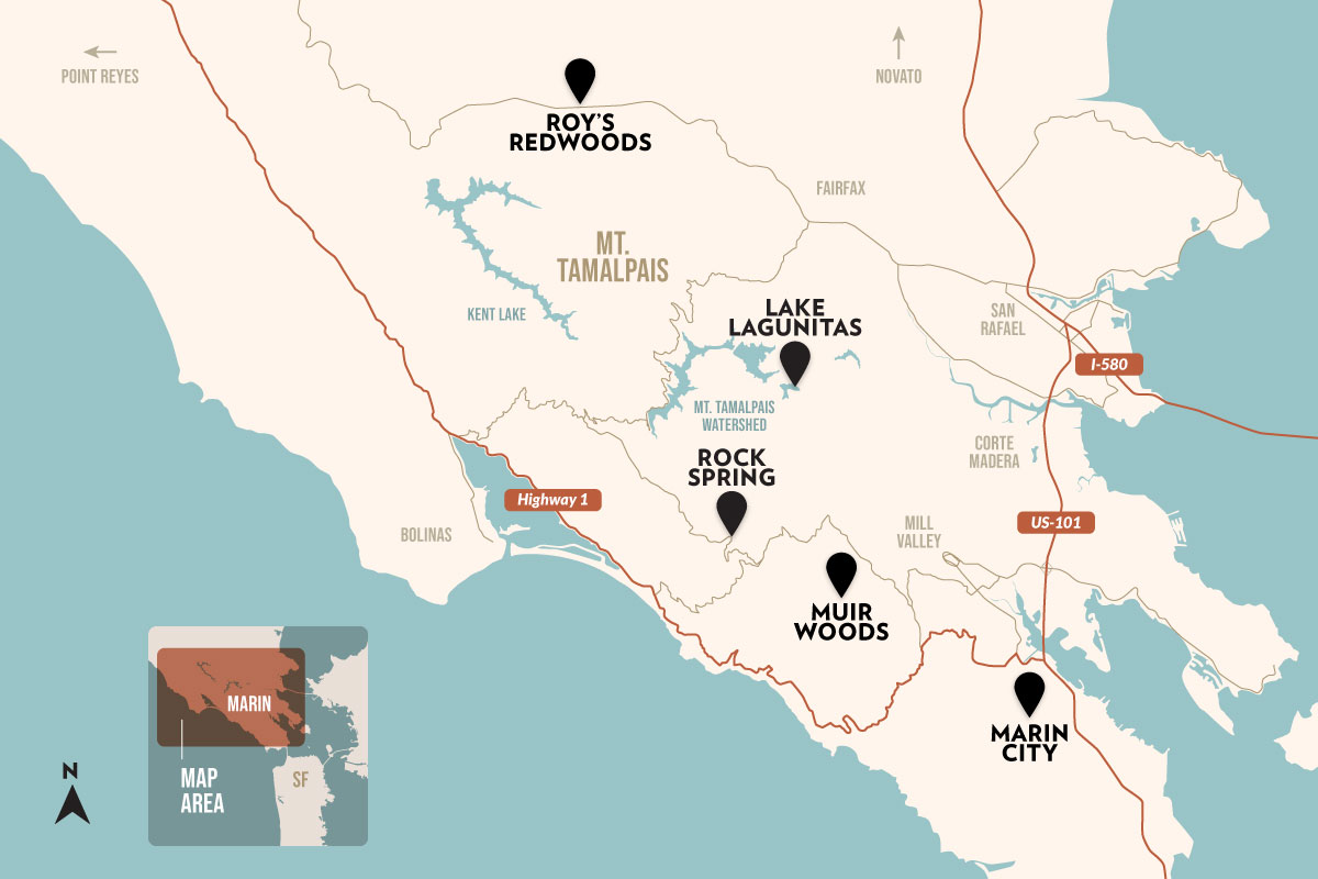
Self-guided Forest Walk at Rock Spring

Self-guided Forest Walk at Roy's Redwoods Preserve
© 2026 Golden Gate National Parks Conservancy. All rights reserved.