A hike along the SCA Trail will provide a breathless vista of the Golden Gate Bridge and the surrounding Bay. When the sun is shining and the fog is lifted, hiking along this trail will make memories that will last a lifetime.
Picture just you, the chaparral, the crashing waves, the sky, and a trail that runs along the rugged coast just south of Muir Beach. The Pirate's Cove Trail is probably what you've been imagining.
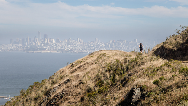
From Skyline College, you'll be shocked by how quickly you can leave civilization. Begin the climb through the trees to a view of Rockaway Beach. You'll have some great ocean views during this portion of the trail.
The trail turns away from the ocean, and you view the valley below.
Highway 101 lies just below this trail. Take your time and enjoy the views in the canyon as you make your way up the hill side, and look out over the bay as you follow numerous switchbacks.
Before San Francisco became the bustling city we know today, a large part of it was made up of coastal sand dunes. With the development of San Francisco over two centuries, much of the native landscape no longer exists.
During the Civil War, the U.S. Army hastily built two batteries, armed with 10-inch Rodman guns, at a site that locals called Black Point. These armaments at Point San Jose Military Reservation (later called Fort Mason) served as backup to the fortifications on Alcatraz and at Fort Point.
After visiting Cavallo Point and the beautifully restored Colonial Revival buildings along the main parade at Fort Baker, be sure to make a side trip to Battery Yates, located just off Satterlee Road.
At the rear of the newer Cavallo Point buildings at Fort Baker, you'll discover a set of stairs that connect you with the Drown Road Trail. Highlights include sensational views of the Golden Gate, and, of course, the historic post chapel itself (now a picturesque event and wedding venue).