El Niño is here: Bay Area park safety and climate resilience

Kelly Sullivan / For the Parks Conservancy
This winter, El Niño could mean more rain, higher tides and stormier weather around the Bay Area. That can mean flooded trails, roads and beaches in the Golden Gate National Recreation Area (GGNRA), Marin park sites around Mt. Tamalpais, and beyond. Heading out to the parks in late 2026 or early 2027? See our safety tips below.
“We know there will be more water affecting our shorelines and trails as the climate changes," said Rob LaPorte, senior project manager at the Parks Conservancy. "Our job is to anticipate those conditions, so we can help these places adapt while continuing to provide access for people and habitat for plants and wildlife."
Fortunately, building resilience in these parklands is already part of our work, and the community is an essential part of it. With the support of our members and volunteers, the Parks Conservancy and our partners have been restoring and stewarding habitats and trails in the parks for years, and we're working to respond directly to climate impacts.
Here's a look at some of the Bay Area park sites that could be impacted by El Niño and how our work is taking shape:
Bothin Marsh
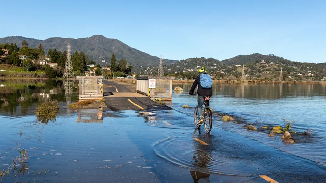
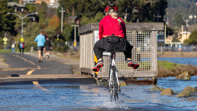
At Bothin Marsh, an area that experiences frequent flooding, rising seas are already reshaping the future of a popular Bay Trail and the tidal wetland around it. The Parks Conservancy and One Tam partners have been working for years on a plan to preserve the trail while helping the marsh adapt naturally to higher water. Tidal marshes like these are home to many species and act as a natural buffer between land and water, and Bothin Marsh is one of the most significant ones left in the Bay Area.
Stinson Beach
At Stinson Beach and adjoining Bolinas Lagoon, sea level rise and intense storms can mean more flooding and less dune and wetland habitat for wildlife and natural flood protection. Through efforts like the Bolinas Lagoon Wye Wetlands Resiliency Project and Stinson Adaptation & Resilience Collaboration, we're studying changes, restoring and enhancing ecosystems, and coming up with roadmaps for resilience.
Crissy Field
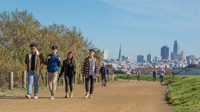
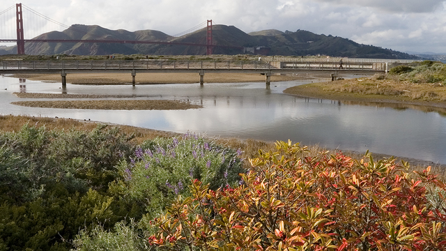
As we celebrate 25 years since the major transformation that turned Crissy Field from a defunct airstrip into a beloved park for all, we're also focused on what could be next along the shore. Climate modeling shows how sea level rise combined with major storms could dramatically expand flooding here in the decades ahead. The restoration 25 years ago laid an important foundation for more resilient shoreline parks here and across the Bay Area. The challenge ahead is how to help these places adapt to increased flooding while maintaining space in this city oasis for nature to thrive and people to enjoy.
Across the coast: Building resilience park-by-park
At the Parks Conservancy, we know climate resilience starts long before the next storm arrives. Sea level rise has multiple impacts and is compounded by storm surges, king tides, and site-specific features. From Redwood Creek to Ocean Beach, each place has its own mix of local factors that must be considered when planning for adaptation. El Niño is like a preview of the future—and a reminder of why that planning work is vital today.
How you can help
Building climate resilience takes long-term commitment. The Parks Conservancy works alongside partners, volunteers and communities to help these places adapt and thrive. That includes projects like Redwood Renewal at Muir Woods, where restoration work is improving habitat for endangered coho salmon and strengthening the health of the Redwood Creek watershed.
Your support turns climate solutions into action. It powers hands-on restoration, community science that keeps a pulse on ecosystems, and the ongoing care that helps the parks adapt to changing conditions and thrive into the future.
Community scientists help monitor a changing landscape
An important way to help is just by observing. By logging into iNaturalist and participating in efforts like El Niño Watch California from the California Academy of Sciences, you can help researchers understand how species and ecosystems respond to unusual conditions and inform how we care for these places. You can also help document king tides, the highest predicted tides of the year, and how they affect shorelines by sharing your photos with the California King Tides Project.
Keep an eye on our events calendar for upcoming winter bioblitzes or other volunteer events in the parks where you can help document plants and wildlife, or dig into the dirt to help the parks bounce back from storms.
Stay safe when the water rises
Always plan ahead before heading to the parks: check park alerts and conditions
- Check NPS and local government alerts before leaving home. Trails, roads and parking areas may close because of flooding or storm damage.
- Know the tides and weather forecast. Conditions can change quickly at beaches or where trails run alongside the ocean, bay, or creeks.
- Never drive through a flooded roadway. Access to places including Tennessee Valley, Muir Beach, and other parks can be affected when low-lying Marin roads flood.
- Use extra caution around creeks and steep terrain. Heavy rain can damage trails, roads and bridges.
- Sometimes the best way to care for the parks is to give them space until conditions improve.
Resources
- NPS Golden Gate National Recreation Area alerts
- One Tam partner agencies: Marin County Parks | Marin Water | California State Parks
- Golden Gate Bridge Highway & Transportation District
- National Weather Service San Francisco Bay Area info
- NOAA: What are El Niño and La Niña?
- KQED: What to expect for Bay Area park-goers this winter