Trail
Length
0.20 miles round-trip
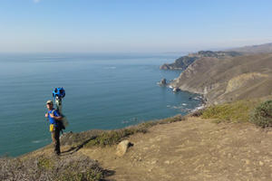
Some of the most eye-popping vistas in the Bay Area—beloved by Golden Gate Raptor Observatory staff and volunteers who annually monitor the fall migration from Hawk Hill—are available to individuals with a wide range of abilities.

Hiking
- Hikes
Take Golden Gate 70/80 from Civic Center in San Francisco to Marin City transfer station. A short walk through a residential neighborhood will lead you to the Pacheco Fire Road trail head. The trail begins under the cover of gorgeous eucalyptus trees, but quickly becomes exposed to the sun as...

Hiking
- Birding
Beautiful ocean views abound as you meander through picturesque Headlands scenery. This hike to Hill 88, the launch site for Cold War missiles, is a joy in spring: Wildflowers everywhere, great views, no fog. The views offshore on a clear day are amazing, and the highlight is seeing a pond...
Trail
Length
2.96 miles round-trip
During the Cold War, anti-aircraft missile stations were constructed on the northern and southern sides of Rodeo Lagoon in the Marin Headlands . Radar sites were placed atop Hawk Hill and Hill 88. When the military decommissioned these stations, they left the remnants of the buildings and structures in place...

Trail
Length
3.26 miles round-trip
This trail segment, technically part of the Coastal Trail, takes visitors past jaw-dropping views of the Marin Headlands and valleys, on the way to a beautiful lookout point and, beyond that, Black Sands Beach. In the spring, you're treated to a stunning trailside display of wildflowers. But always be prepared...

Trail
Length
2.25 miles round-trip
The steep, mile-long trail to the cove begins at the parking area above Battery Spencer on Conzelman Road—eye-level with the Golden Gate Bridge's towers—and descends through a grove of cypress, eucalyptus, and pine.

Trail
Length
3.18 miles round-trip
Rodeo Lagoon offers habitat for birds, butterflies, and bobcats—as well as miles of backcountry and coastal trails.
Trail
Length
0.70 miles round-trip
This hike will take you to the top of one of the most famous lookout spots in the Marin Headlands , and is an easy jaunt from San Francisco. Get there by taking the twisty and scenic Conzelman Road, which offer many amazing lookout spots with ample parking. Pull over...

Hiking
- Hikes
This hike will take you to the top of one of the most famous lookout spots in the Marin Headlands , and is an easy jaunt from San Francisco. Get there by taking the twisty and scenic Conzelman Road, which offers many amazing lookout spots with ample parking. Pull over...

Trail
Length
7.80 miles round-trip
Take Golden Gate 70/80 from Civic Center in San Francisco to Marin City transfer station. A short walk through a residential neighborhood will lead you to the Pacheco Fire Road trail head. The trail begins under the cover of gorgeous eucalyptus trees, but quickly becomes exposed to the sun as...

Trail
Length
2.90 miles round-trip
Named for an ill-fated residential development called Marincello, this trail tracks along what was supposed to be the main thoroughfare of the failed 1960s-era project. Here both the Pacific and the Bay are visible from the narrow ridgeback. Stay right on the rocky wide road down the short 0.3 mile...

Trail
Length
7.70 miles round-trip
Ditch the summer fog in San Francisco for the sunny peaks of our Golden Gate National Parks in Marin County. Have some fun in the sun on this moderate eight mile hike and finish it off with a frothy pint at the local English inn! Along the way, you'll see...